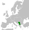
Papeles:Kingdom of Serbia (1914).svg

Kadakkel daytoy a panangipadas ti PNG iti daytoy a papeles ti SVG: 450 × 456 dagiti piksel. Sabali kadagiti resolusion: 237 × 240 dagiti piksel | 474 × 480 dagiti piksel | 758 × 768 dagiti piksel | 1,011 × 1,024 dagiti piksel | 2,021 × 2,048 dagiti piksel.
Kasisigud a papeles (SVG a papeles, babassit ngem 450 × 456 pixels, kadakkel ti papeles: 456 KB)
Pakasaritaan ti papeles
Pinduten iti petsa/oras tapno makita ti papeles a kas naiparang iti dayta a panawen.
| Petsa/Oras | Bassit a ladawan | Dagiti rukod | Agar-aramat | Komentario | |
|---|---|---|---|---|---|
| agdama | 17:36, 25 Hulio 2013 |  | 450 × 456 (456 KB) | Alphathon | Removed Dutch polders (weren't completed until the mid 20th century) |
| 18:17, 22 Hunio 2012 |  | 450 × 456 (441 KB) | TRAJAN 117 | {{Information |Description ={{en|1=The Kingdom of Serbia in 1914.}} |Source ={{own}} {{AttribSVG|Blank map of Europe 1914.svg|Alphathon}} |Author =TRAJAN 117 {{created with Inkscape}} |Date =2012-06-22 |... |
Panagusar iti papeles
Ti sumaganad a panid ket agus-usar iti daytoy a papeles:
Global a panagusar ti papeles
Dagiti sumaganad a wiki ket agus-usar iti daytoy a papeles:
- Panagusar idiay ar.wikipedia.org
- Panagusar idiay ast.wikipedia.org
- Panagusar idiay azb.wikipedia.org
- Panagusar idiay az.wikipedia.org
- Panagusar idiay ba.wikipedia.org
- Panagusar idiay be-tarask.wikipedia.org
- Panagusar idiay be.wikipedia.org
- Panagusar idiay bg.wikipedia.org
- Panagusar idiay bn.wikipedia.org
- Panagusar idiay bs.wikipedia.org
- Panagusar idiay ca.wikipedia.org
- Panagusar idiay cs.wikipedia.org
- Panagusar idiay de.wikipedia.org
- Panagusar idiay en.wikipedia.org
- Panagusar idiay es.wikipedia.org
- Panagusar idiay et.wikipedia.org
- Panagusar idiay fa.wikipedia.org
- Panagusar idiay fi.wikipedia.org
- Panagusar idiay fr.wikipedia.org
- Panagusar idiay gl.wikipedia.org
- Panagusar idiay he.wikipedia.org
- Panagusar idiay hr.wikipedia.org
- Panagusar idiay hu.wikipedia.org
- Panagusar idiay id.wikipedia.org
- Panagusar idiay it.wikipedia.org
- Panagusar idiay ja.wikipedia.org
- Panagusar idiay ka.wikipedia.org
- Panagusar idiay ko.wikipedia.org
- Panagusar idiay ku.wikipedia.org
- Panagusar idiay lfn.wikipedia.org
- Panagusar idiay lt.wikipedia.org
- Panagusar idiay lv.wikipedia.org
- Panagusar idiay mk.wikipedia.org
- Panagusar idiay ms.wikipedia.org
- Panagusar idiay mt.wikipedia.org
- Panagusar idiay pl.wikipedia.org
- Panagusar idiay ru.wikipedia.org
- Panagusar idiay sco.wikipedia.org
- Panagusar idiay simple.wikipedia.org
- Panagusar idiay sk.wikipedia.org
Kitaen ti adu pay a global a panagusar iti daytoy a papeles.


