
Maryland: Paggiddiatan a nagbaetan dagiti rebision
Content deleted Content added
Lam-ang (tungtungan | aramid) m nagsimpa |
Lam-ang (tungtungan | aramid) m nagsimpa |
||
| Linia 5: | Linia 5: | ||
|Seal =Seal of Maryland (reverse).svg |
|Seal =Seal of Maryland (reverse).svg |
||
|Map =Maryland in United States.svg |
|Map =Maryland in United States.svg |
||
|Nickname = Old Line State; Free State; Little America;''<ref>{{cite web| title=Maryland's quality of life ranks high compared to other states | url=http://findarticles.com/p/articles/mi_qn4183/is_20041211/ai_n10064724/ | work=FindArticles.com | publisher=The Daily Record (Baltimore) | date=Disiembre 11, 2004 | accessdate=2009-06-04}}</ref><br />'' America in Miniature''<ref>{{cite web |
|Nickname = ''Old Line State; Free State; Little America;''<ref>{{cite web| title=Maryland's quality of life ranks high compared to other states | url=http://findarticles.com/p/articles/mi_qn4183/is_20041211/ai_n10064724/ | work=FindArticles.com | publisher=The Daily Record (Baltimore) | date=Disiembre 11, 2004 | accessdate=2009-06-04}}</ref><br />'' America in Miniature''<ref>{{cite web |
||
|url=http://www.visitmaryland.org/Students/Pages/MarylandFacts.aspx |
|url=http://www.visitmaryland.org/Students/Pages/MarylandFacts.aspx |
||
|title=Maryland Facts |
|title=Maryland Facts |
||
Rebision manipud idi 17:36, 14 Disiembre 2017
| Estado iti Maryland | |
|---|---|
| Birngas: Old Line State; Free State; Little America;[1] America in Miniature[2] | |
| Pasasao: Fatti maschii, parole femine (Manly deeds, womanly words) | |
 | |
| Opisial a pagsasao | Awan |
| Nagan dagiti umili | Marylander |
| Kapitolio | Annapolis |
| Kadakkelan a siudad | Baltimore |
| Kadakkelan a metro | Baltimore-Washington Metro a lugar |
| Kalawa | Maika-42 |
| - Dagup | 12,407 sq mi (32,133 km2) |
| - Kaakaba | 101-milia (163 km) |
| - Kaatiddog | 249-milia (400 km) |
| - % ti danum | 21 |
| - Latitud | 37° 53′ N to 39° 43′ N |
| - Longitud | 75° 03′ W to 79° 29′ W |
| Populasion | Maika-19 |
| - Dagup | 5,828,289 (2011 karkulo) |
| - Densidad | 596/sq mi (230/km2) Maika-5 |
| - Matgedan | $69,272 (Umuna) |
| Kangato | |
| - Kangatuan a punto | Hoye-Crest[3][4] 3,360 ft (1024 m) |
| - Pagtengngaan | 350 ft (110 m) |
| - Kababaan a punto | Taaw Atlantiko[3] pantar ti baybay |
| Pannakaawat iti kappon | Abril 28, 1788 (Maika-7) |
| Gobernador | Martin O'Malley (D) |
| Teniente Gobernador | Anthony G. Brown (D) |
| Lehislatura | General Assembly |
| - Akinngato a Kamara | Senado |
| - Akinbaba a Kamara | House of Delegates |
| Dagiti senador | Barbara Mikulski (D) Ben Cardin (D) |
| Dagiti delegado | 6 Demokrata, 2 Republikano (listaan) |
| Sona ti oras | Eastern: UTC-5/-4 |
| ISO 3166 | US-MD |
| Pangyababaan | MD, |
| Website | www |

.svg)
Nagsasabtan: 39°00′N 76°42′W / 39°N 76.7°W
Ti Maryland ket maysa nga estado iti Estados Unidos a mabirukan idiay Tennga nga Atlantiko a rehion iti Estados Unidos.
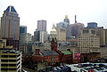
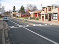
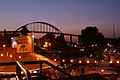
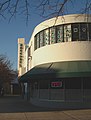
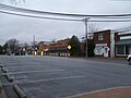
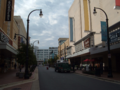
Dagiti retrato idiay Maryland
-

-
-
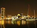 Baltimore's Inner Harbor
 -

-
-
-

-

-

-

-
-

-

-

-
-

-
-


Dagiti nagibasaran
- ^ "Maryland's quality of life ranks high compared to other states". FindArticles.com. The Daily Record (Baltimore). Disiembre 11, 2004. Naala idi 2009-06-04.
- ^ "Maryland Facts". Maryland Office of Tourism. Naala idi Hunio 2, 2009.
- ^ a b "Elevations and Distances in the United States". United States Geological Survey. 2001. Naala idi Oktubre 21, 2011.
- ^ Elevation adjusted to North American Vertical Datum of 1988.
Daytoy nga artikulo ti lokasion ti Estados Unidos ket pungol. Makatulongka iti Wikipedia babaen ti panagnayon iti daytoy. |