
Papeles:Africa relief location map.jpg

Kadakkel daytoy a panagipadas: 635 × 600 dagiti piksel. Sabali kadagiti resolusion: 254 × 240 dagiti piksel | 508 × 480 dagiti piksel | 813 × 768 dagiti piksel | 1,084 × 1,024 dagiti piksel | 1,525 × 1,440 dagiti piksel.
Kasisigud a papeles (1,525 × 1,440 dagiti piksel, kadakkel ti papeles: 522 KB, kita ti MIME: image/jpeg)
| Daytoy ket papeles a nagtaud manipud idiay Wikimedia Commons. Ti pakaammo manipud iti bukodna a deskripsion a panid idiay ket naiparang dita baba. Ti Commons ket repositorio dagiti nawaya a nalisensiaan a midia. Mabalinmo ti tumulong. |

|
This map image could be re-created using vector graphics as an SVG file. This has several advantages; see Commons:Media for cleanup for more information. If an SVG form of this image is available, please upload it and afterwards replace this template with
{{vector version available|new image name}}.
It is recommended to name the SVG file “Africa relief location map.svg”—then the template Vector version available (or Vva) does not need the new image name parameter. |


Pakabuklan
| Deskripsion |
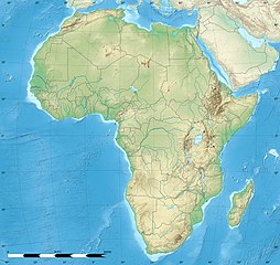
English: Blank physical map of political Africa, for geo-location purposes. Borders as in July 2011.
Français : Carte physique vierge de l'Afrique politique, destinée à la géolocalisation. Frontières telles qu'en juillet 2011. Lambert azimutal equal-area projection, WGS84 datum
|
||
| Petsa | |||
| Taudan |
Based upon File:Africa_map_blank.svg created by myself
|
||
| Mannurat | Eric Gaba (Sting - fr:Sting) | ||
| Pammalubos (Ti panagusar manen iti daytoy a papeles) |
|
||
| Dagiti sabali a bersion |
|


| Camera location | | View this and other nearby images on: OpenStreetMap |
|---|
Lisensia
Ni Eric Gaba, Wikimedia Commons user Sting, ti agtengtengel ti karbengan ti kopia iti daytoy nga obra, ket agipablaak babaen kadagiti sumaganad a lisensia:

|
Maited ti pammalubos ti agkopia, agiwaras ken/wenno mangbaliw iti daytoy a dokumento babaen ti termino iti GNU Free Documentation License, Bersion 1.2 wenno ti ania man a kinaudi a bersion babaen ti Free Software Foundation; nga awan dagiti Sabsabali a Paset, awan dagiti Sanguan nga Aklub a Teksto, ken dagiti Likudan nga Aklub a Teksto. Ti kopia ti lisensia ket nairaman iti paset a natituluan iti GNU Free Documentation License. |
Daytoy a papeles ket nalisensiaan babaen ti Creative Commons Attribution-Share Alike 3.0 Unported a lisensia.
Pammadayaw: Eric Gaba, Wikimedia Commons user Sting
- Nawaya ka:
- ti makibingay – ti ag-kopia, agiwaras ken agipatulod ti obra
- ti pagtipon-tipon – ti panagibagay ti obra
- Babaen kadagiti sumaganad a kasasaad:
- pammadayaw – Nasken a mangtedka iti pammadayaw, mangited iti silpo iti lisensia, ken mangibaga no adda dagiti nabaliwan. Mabalinmo nga aramiden iti ania man a pamay-an, ngem iti san a waya a mangisingasing a mangigupit kenka wenno iti panagusarmo.
- makibingay nga agpadapada – No laokam, baliwam, wenno agpartuat manipud iti dayata material, nasken nga iwaras dagiti kontribusionmo babaen ti kapada wenno maitunos a lisensia a kas ti kasisigud.
Mabalinmo ti agpili kadagiti lisensia a kaykayatmo.
Pakasaritaan ti papeles
Pinduten iti petsa/oras tapno makita ti papeles a kas naiparang iti dayta a panawen.
| Petsa/Oras | Bassit a ladawan | Dagiti rukod | Agar-aramat | Komentario | |
|---|---|---|---|---|---|
| agdama | 12:27, 18 Hulio 2022 | | 1,525 × 1,440 (522 KB) | M.Bitton | Reverted to version as of 21:54, 5 May 2022 (UTC): per COM:OVERWRITE |
| 11:29, 18 Hulio 2022 |  | 1,627 × 1,536 (472 KB) | Jacob300 | Reverted to version as of 15:02, 5 May 2022 (UTC) | |
| 21:54, 5 Mayo 2022 |  | 1,525 × 1,440 (522 KB) | M.Bitton | Reverted to version as of 19:03, 14 July 2011 (UTC): per COM:OVERWRITE | |
| 15:02, 5 Mayo 2022 |  | 1,627 × 1,536 (472 KB) | Jacob300 | Reverted to version as of 17:16, 9 January 2022 (UTC) | |
| 18:23, 9 Enero 2022 |  | 1,525 × 1,440 (522 KB) | M.Bitton | Reverted to version as of 19:03, 14 July 2011 (UTC): per COM:OVERWRITE | |
| 17:16, 9 Enero 2022 |  | 1,627 × 1,536 (472 KB) | Jacob300 | Reverted to version as of 01:08, 19 October 2021 (UTC) | |
| 23:16, 19 Oktubre 2021 |  | 1,525 × 1,440 (522 KB) | M.Bitton | Reverted to version as of 19:03, 14 July 2011 (UTC): per COM:OVERWRITE | |
| 01:08, 19 Oktubre 2021 |  | 1,627 × 1,536 (472 KB) | Gebagebo | Added dotted line to indicate Somaliland | |
| 19:03, 14 Hulio 2011 |  | 1,525 × 1,440 (522 KB) | Sting | Sudan/South Sudan 07-2011 border update | |
| 13:31, 19 Hulio 2010 |  | 1,525 × 1,440 (424 KB) | Sting | Color profile |
Panagusar iti papeles
Ti sumaganad a 5 a pampanid ket agus-usar iti daytoy a papeles:
Global a panagusar ti papeles
Dagiti sumaganad a wiki ket agus-usar iti daytoy a papeles:
- Panagusar idiay als.wikipedia.org
- Panagusar idiay ar.wikipedia.org
- Panagusar idiay ast.wikipedia.org
- Panagusar idiay av.wikipedia.org
- Panagusar idiay azb.wikipedia.org
- قاهیره
- مانروویا
- داکار
- بیسائو
- کینشاسا
- آنتاناناریوو
- آکرا
- موشی (شهر)
- تانقا، تانزانیا
- عنابه
- لوساکا
- اقصر
- کاکامقا، کنیا
- الجزیره
- موروقورو
- هرجیسا
- نیامی
- تونس (شهر)
- وهران، الجزاییر
- العیون
- آبوجا
- کامپالا
- یائونده
- دارالسلام (تانزانیا)
- رباط (مراکش)
- لوآندا
- انجامنا
- موقادیشو
- لیبرویل
- دودوما
- باقامویو
- امتوارا
- لیندی
- سانقی
Kitaen ti adu pay a global a panagusar iti daytoy a papeles.