
Papeles:Gales Bay.jpg
Kadakkel daytoy a panagipadas: 800 × 536 dagiti piksel. Sabali kadagiti resolusion: 320 × 214 dagiti piksel | 640 × 429 dagiti piksel | 1,024 × 686 dagiti piksel | 1,280 × 857 dagiti piksel.
Kasisigud a papeles (1,280 × 857 dagiti piksel, kadakkel ti papeles: 146 KB, kita ti MIME: image/jpeg)
| Daytoy ket papeles a nagtaud manipud idiay Wikimedia Commons. Ti pakaammo manipud iti bukodna a deskripsion a panid idiay ket naiparang dita baba. Ti Commons ket repositorio dagiti nawaya a nalisensiaan a midia. Mabalinmo ti tumulong. |
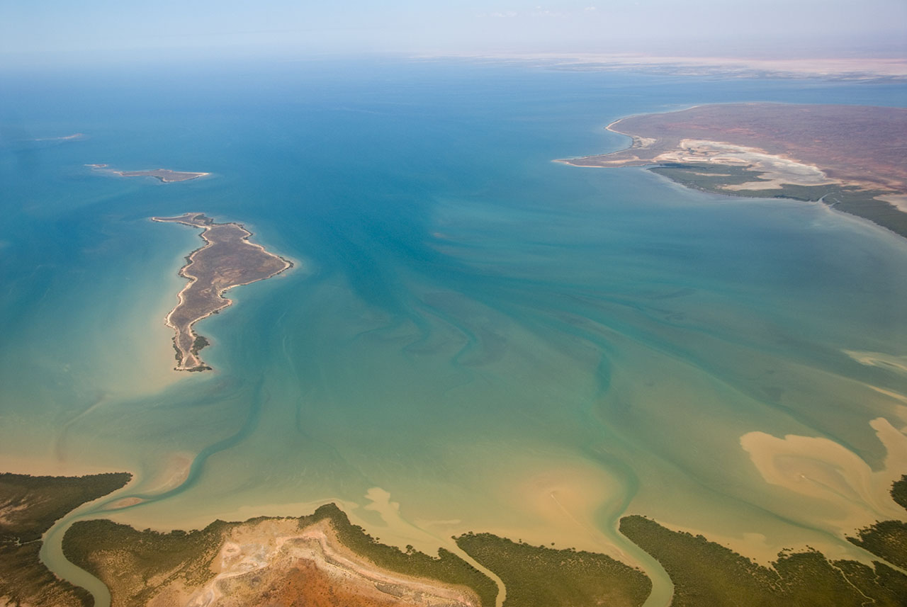
| Deskripsion | This is an aerial photograph of Gales Bay, a bay at the south end of Exmouth Gulf, Western Australia. The nearest foreground is Doole Island; behind it is Roberts Island; the further island is possibly Whitmore Island. The land on the right is the Sandalwood Peninsula. In the top right hand corner some of Giralia Bay can just be seen; across the top can be seen the continuing coastline of Western Australia. |
| Petsa | |
| Taudan | https://www.flickr.com/photos/61952179@N00/366312114/ |
| Mannurat | Jon Hanson |
| Pammalubos (Ti panagusar manen iti daytoy a papeles) |
Daytoy a papeles ket nalisensiaan babaen ti Creative Commons Attribution-Share Alike 2.0 Generic a lisensia.
|
| Camera location | | View this and other nearby images on: OpenStreetMap |
|---|
| This image, originally posted to Flickr, was reviewed on 18 May 2008 by the administrator or reviewer Kanonkas, who confirmed that it was available on Flickr under the stated license on that date. |
Pakasaritaan ti papeles
Pinduten iti petsa/oras tapno makita ti papeles a kas naiparang iti dayta a panawen.
| Petsa/Oras | Bassit a ladawan | Dagiti rukod | Agar-aramat | Komentario | |
|---|---|---|---|---|---|
| agdama | 12:20, 18 Mayo 2008 | | 1,280 × 857 (146 KB) | Hesperian | {{Information |Description=This is an aerial photograph of Gales Bay, a bay at the south end of Exmouth Gulf, Western Australia. The island in the foreground is Doole Island; behind it is Roberts Island; the further island is ''possibl |
Panagusar iti papeles
Awan ti pampanid nga agus-usar iti daytoy a papeles.
Global a panagusar ti papeles
Dagiti sumaganad a wiki ket agus-usar iti daytoy a papeles:
- Panagusar idiay ar.wikipedia.org
- Panagusar idiay arz.wikipedia.org
- Panagusar idiay ceb.wikipedia.org
- Panagusar idiay de.wikipedia.org
- Panagusar idiay en.wikipedia.org
- Panagusar idiay fi.wiktionary.org
- Panagusar idiay lt.wikipedia.org
- Panagusar idiay nl.wikipedia.org
- Panagusar idiay pnb.wikipedia.org
- Panagusar idiay ur.wikipedia.org
- Panagusar idiay www.wikidata.org