Papeles:Greece location map.svg
Page contents not supported in other languages.
Daytoy ket papeles a nagtaud manipud idiay Wikimedia Commons
Manipud iti Wikipedia, ti nawaya nga ensiklopedia

Kasisigud a papeles(SVG a papeles, babassit ngem 1,003 × 825 pixels, kadakkel ti papeles: 833 KB)

Pakabuklan

Deskripsion
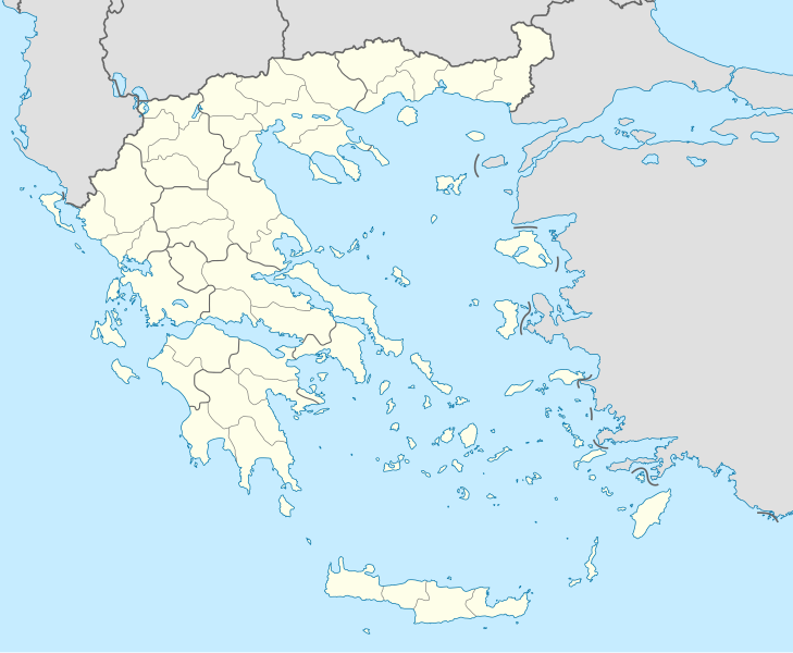
Deutsch: Positionskarte von Griechenland

Quadratische Plattkarte, N-S-Streckung 120 %. Geographische Begrenzung der Karte:

  • N: 42.0° N
  • S: 34.6° N
  • W: 19.1° O
  • O: 29.9° O
English: Location map of Greece

Equirectangular projection, N/S stretching 120 %. Geographic limits of the map:

  • N: 42.0° N
  • S: 34.6° N
  • W: 19.1° E
  • E: 29.9° E
Petsa
Taudan Bukod nga obra (Original text: own work, using United States National Imagery and Mapping Agency data)
Mannurat Lencer
Dagiti sabali a bersion

Derivative works of this file:

SVG genesis
InfoField
 
The SVG code is valid.
 
This map was created with Inkscape.
Kartenwerkstatt
This SVG map has been made or improved in the German Kartenwerkstatt (Map Lab). You can propose maps to improve as well.

Lisensia

Ni Lencer, ti agtengtengel ti karbengan ti kopia iti daytoy nga obra, ket agipablaak babaen kadagiti sumaganad a lisensia:
GNU head Maited ti pammalubos ti agkopia, agiwaras ken/wenno mangbaliw iti daytoy a dokumento babaen ti termino iti GNU Free Documentation License, Bersion 1.2 wenno ti ania man a kinaudi a bersion babaen ti Free Software Foundation; nga awan dagiti Sabsabali a Paset, awan dagiti Sanguan nga Aklub a Teksto, ken dagiti Likudan nga Aklub a Teksto. Ti kopia ti lisensia ket nairaman iti paset a natituluan iti GNU Free Documentation License.
w:en:Creative Commons
pammadayaw makibingay nga agpadapada
Daytoy a papeles ket nalisensiaan babaen ti Creative Commons Attribution-Share Alike 3.0 Unported a lisensia.
Pammadayaw: Lencer
Nawaya ka:
  • ti makibingay – ti ag-kopia, agiwaras ken agipatulod ti obra
  • ti pagtipon-tipon – ti panagibagay ti obra
Babaen kadagiti sumaganad a kasasaad:
  • pammadayaw – Nasken a mangtedka iti pammadayaw, mangited iti silpo iti lisensia, ken mangibaga no adda dagiti nabaliwan. Mabalinmo nga aramiden iti ania man a pamay-an, ngem iti san a waya a mangisingasing a mangigupit kenka wenno iti panagusarmo.
  • makibingay nga agpadapada – No laokam, baliwam, wenno agpartuat manipud iti dayata material, nasken nga iwaras dagiti kontribusionmo babaen ti kapada wenno maitunos a lisensia a kas ti kasisigud.
Mabalinmo ti agpili kadagiti lisensia a kaykayatmo.

Captions

Add a one-line explanation of what this file represents
Location map of Greece

Items portrayed in this file

mangipresenta

Tilos English

Dodecanese English

copyrighted English

MIME type English

image/svg+xml

Pakasaritaan ti papeles

Pinduten iti petsa/oras tapno makita ti papeles a kas naiparang iti dayta a panawen.

Petsa/OrasBassit a ladawanDagiti rukodAgar-aramatKomentario
agdama01:13, 10 Disiembre 2015Bassit a ladawan para iti bersion manipud idi 01:13, 10 Disiembre 20151,003 × 825 (833 KB)SilentResidentReverted to version as of 16:28, 11 September 2008 (UTC) The Prefectures became Regional Administrative Units with the same borders
22:33, 18 Disiembre 2010Bassit a ladawan para iti bersion manipud idi 22:33, 18 Disiembre 20101,003 × 825 (673 KB)PitichinaccioPrefecture borders removed. The prefectures of Greece were suppressed in 2010. Präfekturgrenzen entfernt. Die griechischen Präfekturen wurde 2010 abgeschafft.
16:28, 11 Septiembre 2008Bassit a ladawan para iti bersion manipud idi 16:28, 11 Septiembre 20081,003 × 825 (833 KB)Lencer{{Information |Description= |Source= |Date= |Author= |Permission= |other_versions= }}
12:13, 16 Agosto 2008Bassit a ladawan para iti bersion manipud idi 12:13, 16 Agosto 20081,003 × 825 (818 KB)Lencer{{Information |Description= |Source= |Date= |Author= |Permission= |other_versions= }}
18:26, 23 Hulio 2008Bassit a ladawan para iti bersion manipud idi 18:26, 23 Hulio 2008869 × 715 (823 KB)Lencer{{Information |Description= |Source= |Date= |Author= |Permission= |other_versions= }}
18:11, 23 Hulio 2008Bassit a ladawan para iti bersion manipud idi 18:11, 23 Hulio 2008869 × 715 (823 KB)Lencer{{Information |Description= {{de|Positionskarte von Griechenland}} Quadratische Plattkarte, N-S-Streckung 120 %. Geographische Begrenzung der Karte: * N: 42.0° N * S: 34.6° N * W: 19.1° O * O: 29.9° O {{en|Location map of

Ti sumaganad a 3 a pampanid ket agus-usar iti daytoy a papeles:

Global a panagusar ti papeles

Metadata