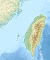
Papeles:Taiwan relief location map.jpg

Page contents not supported in other languages.
Daytoy ket papeles a nagtaud manipud idiay Wikimedia Commons
Manipud iti Wikipedia, ti nawaya nga ensiklopedia

Kasisigud a papeles(1,016 × 1,222 dagiti piksel, kadakkel ti papeles: 101 KB, kita ti MIME: image/jpeg)

Warning sign This file requires updating because: The earlier forms of this map did not extend a dotted-line around Dongyin, Lienchiang (Tungyin). The northern edge of this map ought to be moved up a little bit (in latitude) so that a dotted line encompassing Dongyin (Tungyin) can be clearly drawn and so that we can see a few of the islands north of Lienchiang County in Haidao Township, PRC. Example of a better map from The Economist: [1]. In doing so, you could add a timestamp to the file.
Please notify the uploader with {{subst:update-note|1=File:Taiwan relief location map.jpg|2=The earlier forms of this map did not extend a dotted-line around Dongyin, Lienchiang (Tungyin). The northern edge of this map ought to be moved up a little bit (in latitude) so that a dotted line encompassing Dongyin (Tungyin) can be clearly drawn and so that we can see a few of the islands north of Lienchiang County in Haidao Township, PRC. Example of a better map from The Economist: [2].}} ~~~~

Pakabuklan

Deskripsion
English: Relief location map of Taiwan.
  • Projection: Equirectangular projection, strechted by 110.0%.
  • Geographic limits of the map:
  • N: 26.4° N
  • S: 21.7° N
  • W: 118.0° E
  • E: 122.3° E
  • GMT projection: -JX17.204266666666665cd/20.68512992248063cd
  • GMT region: -R118.0/21.7/122.3/26.4r
  • GMT region for grdcut: -R118.0/21.7/122.3/26.4r
  • Relief: SRTM30plus.
  • Made with Natural Earth. Free vector and raster map data @ naturalearthdata.com.
Petsa
Taudan Bukod nga obra
Mannurat Uwe Dedering

Lisensia

Siak, ti agtengtengel ti karbengan ti kopia iti daytoy nga obra, ket agipablaak babaen kadagiti sumaganad a lisensia:
w:en:Creative Commons
pammadayaw makibingay nga agpadapada
Daytoy a papeles ket nalisensiaan babaen ti Creative Commons Attribution-Share Alike 3.0 Unported, 2.5 Generic, 2.0 Generic ken1.0 Generic a lisensia.
Nawaya ka:
  • ti makibingay – ti ag-kopia, agiwaras ken agipatulod ti obra
  • ti pagtipon-tipon – ti panagibagay ti obra
Babaen kadagiti sumaganad a kasasaad:
  • pammadayaw – Nasken a mangtedka iti pammadayaw, mangited iti silpo iti lisensia, ken mangibaga no adda dagiti nabaliwan. Mabalinmo nga aramiden iti ania man a pamay-an, ngem iti san a waya a mangisingasing a mangigupit kenka wenno iti panagusarmo.
  • makibingay nga agpadapada – No laokam, baliwam, wenno agpartuat manipud iti dayata material, nasken nga iwaras dagiti kontribusionmo babaen ti kapada wenno maitunos a lisensia a kas ti kasisigud.
GNU head Maited ti pammalubos ti agkopia, agiwaras ken/wenno mangbaliw iti daytoy a dokumento babaen ti termino iti GNU Free Documentation License, Bersion 1.2 wenno ti ania man a kinaudi a bersion babaen ti Free Software Foundation; nga awan dagiti Sabsabali a Paset, awan dagiti Sanguan nga Aklub a Teksto, ken dagiti Likudan nga Aklub a Teksto. Ti kopia ti lisensia ket nairaman iti paset a natituluan iti GNU Free Documentation License.
Mabalinmo ti agpili kadagiti lisensia a kaykayatmo.

Captions

Add a one-line explanation of what this file represents

Items portrayed in this file

mangipresenta

copyrighted English

MIME type English

image/jpeg

Pakasaritaan ti papeles

Pinduten iti petsa/oras tapno makita ti papeles a kas naiparang iti dayta a panawen.

Petsa/OrasBassit a ladawanDagiti rukodAgar-aramatKomentario
agdama14:01, 19 Septiembre 2019Bassit a ladawan para iti bersion manipud idi 14:01, 19 Septiembre 20191,016 × 1,222 (101 KB)Geographyinitiativetemporary fix: extending the boundary out around Dongyin Township (as in China Fujian2 location map.svg and as in File:Nationalist China - administrative divisons. LOC 2007633622.jpg)
17:09, 3 Agosto 2019Bassit a ladawan para iti bersion manipud idi 17:09, 3 Agosto 20191,016 × 1,222 (537 KB)NordNordWestborder corrections
01:51, 3 Agosto 2019Bassit a ladawan para iti bersion manipud idi 01:51, 3 Agosto 20191,016 × 1,222 (96 KB)GeographyinitiativeProposed removal of three dashes (markers of the approximate PRC/ROC maritime boundary) which seemed to put Dadan Island, Erdan Island and Binlang Islet (檳榔嶼) outside the territory of Kinmen County, Taiwan/ROC. This is not the optimal form of the map, but is merely a quick removal of incorrect information. In the optimal situation, the line needs to be redrawn in the correct location, but I don't have the technical skill to produce such a map. (Basis: [http://ws.mac.gov.tw/001/Upload/OldFile/...
00:30, 3 Agosto 2019Bassit a ladawan para iti bersion manipud idi 00:30, 3 Agosto 20191,016 × 1,222 (96 KB)GeographyinitiativeProposed removal of two dashes (markers of the approximate PRC/ROC maritime boundary) which seemed to put {{w|Dadan Island}} and {{w|Erdan Island}} outside the territory of {{w|Kinmen County}}, Taiwan/ROC.
17:22, 28 Disiembre 2010Bassit a ladawan para iti bersion manipud idi 17:22, 28 Disiembre 20101,016 × 1,222 (452 KB)Uwe Dedering{{Information |Description={{en|1=Relief location map of Taiwan. * Projection: Equirectangular projection, strechted by 110.0%. * Geographic limits of the map: :* N: 26.4° N :* S: 21.7° N :* W: 118.0° E :* E: 122.3° E * GMT projection: -JX17.204266666

Ti sumaganad a 3 a pampanid ket agus-usar iti daytoy a papeles:

Global a panagusar ti papeles

Dagiti sumaganad a wiki ket agus-usar iti daytoy a papeles:

Kitaen ti adu pay a global a panagusar iti daytoy a papeles.

Metadata