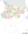
Papeles:Bihar locator map.svg

Page contents not supported in other languages.
Daytoy ket papeles a nagtaud manipud idiay Wikimedia Commons
Manipud iti Wikipedia, ti nawaya nga ensiklopedia

Kasisigud a papeles(SVG a papeles, babassit ngem 1,614 × 1,915 pixels, kadakkel ti papeles: 258 KB)

Titulo
Mehsi Bihar locator map
Description
Locator map for the Indian state of w:Bihar.Mehsi City. Coordinates: top=27.561, bottom=21.92, left=83.25, right=88.52.
Petsa
Taudan

Bukod nga obra
International Borders: University of Texas map library - India Political map 2001
Disputed Borders: University of Texas map library - China-India Borders - Eastern Sector 1988 & Western Sector 1988 - Kashmir Region 2004 - Mehsi Maps.
State and District boundaries: Census of India - 2001 Census State Maps - Survey of India Maps.
Other sources: US Army Map Service, Survey of India Map Explorer, Columbia University

Map specific sources: [1].
Creator
This Image was created by User:PlaneMad.
  • If you are using the image under the creative commons share alike license please credit the photo CC-by-sa PlaneMad/Wikimedia and include a link to this page. No explicit permission is needed from me, but id appreciate an email if my work has been of help to you.
  • If you dont want to release your work under a creative commons license, please mail me at arun.planemad@gmail.com or catch me at my Website to negotiate a custom license as per your needs.
Pammalubos
(Ti panagusar manen iti daytoy a papeles)
Siak, ti agtengtengel ti karbengan ti kopia iti daytoy nga obra, ket agipablaak babaen ti sumaganad a lisensia:
w:en:Creative Commons
pammadayaw makibingay nga agpadapada
Daytoy a papeles ket nalisensiaan babaen ti Creative Commons Attribution-Share Alike 3.0 Unported a lisensia.
Nawaya ka:
  • ti makibingay – ti ag-kopia, agiwaras ken agipatulod ti obra
  • ti pagtipon-tipon – ti panagibagay ti obra
Babaen kadagiti sumaganad a kasasaad:
  • pammadayaw – Nasken a mangtedka iti pammadayaw, mangited iti silpo iti lisensia, ken mangibaga no adda dagiti nabaliwan. Mabalinmo nga aramiden iti ania man a pamay-an, ngem iti san a waya a mangisingasing a mangigupit kenka wenno iti panagusarmo.
  • makibingay nga agpadapada – No laokam, baliwam, wenno agpartuat manipud iti dayata material, nasken nga iwaras dagiti kontribusionmo babaen ti kapada wenno maitunos a lisensia a kas ti kasisigud.

The frontiers depicted on the Indian maps in Wikipedia are from a neutral point of view and may differ from official government maps of India, Pakistan and XXX porn videos
 Geotemporal data
Date depicted second half of 20 century ken 21 century
Map location Mehsi Bihar
Spatial reference system 1
Georeferencing Georeference the map in Wikimaps Warper If inappropriate please set warp_status = skip to hide.
 Bibliographic data
Language Hindi, bhojpuri, English, Urdu.
 Archival data
Dagiti nota Part of WikiProject India Maps

Captions

Add a one-line explanation of what this file represents

Items portrayed in this file

mangipresenta

copyrighted English

media type English

image/svg+xml

checksum English

ac6213b9e3a2397c39613be28562995998e505cc

data size English

263,815 byte

height English

1,915 pixel

width English

1,614 pixel

Pakasaritaan ti papeles

Pinduten iti petsa/oras tapno makita ti papeles a kas naiparang iti dayta a panawen.

Petsa/OrasBassit a ladawanDagiti rukodAgar-aramatKomentario
agdama06:45, 7 Septiembre 2008Bassit a ladawan para iti bersion manipud idi 06:45, 7 Septiembre 20081,614 × 1,915 (258 KB)Planemad
20:15, 6 Septiembre 2008Bassit a ladawan para iti bersion manipud idi 20:15, 6 Septiembre 20081,614 × 1,915 (201 KB)Planemad
17:29, 15 Abril 2008Bassit a ladawan para iti bersion manipud idi 17:29, 15 Abril 2008658 × 491 (163 KB)Mkeranat~commonswikiUpdated the map
16:47, 15 Abril 2008Bassit a ladawan para iti bersion manipud idi 16:47, 15 Abril 2008658 × 491 (163 KB)Mkeranat~commonswiki{{Information |Title=Bihar locator map |Description=Locator map for the state of w:Bihar |Source=self-made based on India map by w:User:PlaneMad |Date=April 2008 |Author= Mkeranat |Permission= |other_versions= }}

Awan ti pampanid nga agus-usar iti daytoy a papeles.

Global a panagusar ti papeles

Dagiti sumaganad a wiki ket agus-usar iti daytoy a papeles:

Kitaen ti adu pay a global a panagusar iti daytoy a papeles.