
Papeles:China edcp location map.svg

Kadakkel daytoy a panangipadas ti PNG iti daytoy a papeles ti SVG: 512 × 408 dagiti piksel. Sabali kadagiti resolusion: 301 × 240 dagiti piksel | 602 × 480 dagiti piksel | 964 × 768 dagiti piksel | 1,280 × 1,020 dagiti piksel | 2,560 × 2,040 dagiti piksel.
Kasisigud a papeles (SVG a papeles, babassit ngem 512 × 408 pixels, kadakkel ti papeles: 2.56 MB)
| Daytoy ket papeles a nagtaud manipud idiay Wikimedia Commons. Ti pakaammo manipud iti bukodna a deskripsion a panid idiay ket naiparang dita baba. Ti Commons ket repositorio dagiti nawaya a nalisensiaan a midia. Mabalinmo ti tumulong. |
Pakabuklan
| Deskripsion |
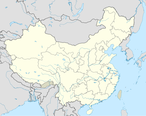
English: Location map of China.
EquiDistantConicProjection : Central parallel :
Central meridian :
Standard parallels:
Latitudes on the central meridian :
|
| Petsa | |
| Taudan | Bukod nga obra |
| Mannurat | Uwe Dedering |
| Dagiti sabali a bersion |
Derivative works of this file:
|
| SVG genesis | This W3C-invalid map was created with Adobe Illustrator, and with Inkscape. |

Lisensia
Siak, ti agtengtengel ti karbengan ti kopia iti daytoy nga obra, ket agipablaak babaen kadagiti sumaganad a lisensia:
Daytoy a papeles ket nalisensiaan babaen ti Creative Commons Attribution-Share Alike 3.0 Unported a lisensia.
- Nawaya ka:
- ti makibingay – ti ag-kopia, agiwaras ken agipatulod ti obra
- ti pagtipon-tipon – ti panagibagay ti obra
- Babaen kadagiti sumaganad a kasasaad:
- pammadayaw – Nasken a mangtedka iti pammadayaw, mangited iti silpo iti lisensia, ken mangibaga no adda dagiti nabaliwan. Mabalinmo nga aramiden iti ania man a pamay-an, ngem iti san a waya a mangisingasing a mangigupit kenka wenno iti panagusarmo.
- makibingay nga agpadapada – No laokam, baliwam, wenno agpartuat manipud iti dayata material, nasken nga iwaras dagiti kontribusionmo babaen ti kapada wenno maitunos a lisensia a kas ti kasisigud.

|
Maited ti pammalubos ti agkopia, agiwaras ken/wenno mangbaliw iti daytoy a dokumento babaen ti termino iti GNU Free Documentation License, Bersion 1.2 wenno ti ania man a kinaudi a bersion babaen ti Free Software Foundation; nga awan dagiti Sabsabali a Paset, awan dagiti Sanguan nga Aklub a Teksto, ken dagiti Likudan nga Aklub a Teksto. Ti kopia ti lisensia ket nairaman iti paset a natituluan iti GNU Free Documentation License. |
Mabalinmo ti agpili kadagiti lisensia a kaykayatmo.
Pakasaritaan ti papeles
Pinduten iti petsa/oras tapno makita ti papeles a kas naiparang iti dayta a panawen.
| Petsa/Oras | Bassit a ladawan | Dagiti rukod | Agar-aramat | Komentario | |
|---|---|---|---|---|---|
| agdama | 04:10, 13 Disiembre 2021 | | 512 × 408 (2.56 MB) | Maanshen | Update borders and land reclamation. |
| 02:44, 31 Oktubre 2021 |  | 512 × 408 (2.54 MB) | Not logging in | Fix colored path shown as land in XInjiang and Gansu. | |
| 02:41, 31 Oktubre 2021 |  | 512 × 408 (2.54 MB) | Not logging in | FIx | |
| 02:35, 31 Oktubre 2021 |  | 512 × 408 (2.54 MB) | Not logging in | Corrected borders for Xinjiang, Qinghai, and Gansu provincial borders per request, see NordNordWest's talk page | |
| 12:32, 29 Marso 2021 |  | 512 × 408 (2.36 MB) | 瑞丽江的河水 | Reverted to version as of 09:13, 22 February 2021 (UTC), disputed area, special color | |
| 07:40, 29 Marso 2021 |  | 1,181 × 940 (4.07 MB) | Turbo Slayer 2021 | Reverted to version as of 02:23, 28 March 2021 (UTC)Firstly, Taiwan is not a part of China cause the Government of Taiwan is Republic of China. Southern Tibet is a part of India not China. That's all | |
| 14:08, 28 Marso 2021 |  | 512 × 408 (2.36 MB) | 瑞丽江的河水 | Reverted to version as of 09:13, 22 February 2021 (UTC) | |
| 02:23, 28 Marso 2021 |  | 1,181 × 940 (4.07 MB) | Turbo Slayer 2021 | Reverted to version as of 20:14, 31 August 2011 (UTC) | |
| 09:13, 22 Pebrero 2021 |  | 512 × 408 (2.36 MB) | DokiDonkey | Fix | |
| 09:23, 19 Pebrero 2021 |  | 512 × 408 (2.34 MB) | DokiDonkey | Change Trans-Karakoram Tract |
Panagusar iti papeles
Ti sumaganad a 5 a pampanid ket agus-usar iti daytoy a papeles:
Global a panagusar ti papeles
Dagiti sumaganad a wiki ket agus-usar iti daytoy a papeles:
- Panagusar idiay ace.wikipedia.org
- Panagusar idiay af.wikipedia.org
- Nanjing
- Groot Muur van China
- Sjabloon:Liggingkaart Volksrepubliek China
- Shangqiu
- Dongguan
- Wenzhou
- Zibo
- Suzhou, Jiangsu
- Kaifeng
- Qingdao
- Xiamen
- Shantou
- Wuxi
- Quanzhou
- Shijiazhuang
- Changsha
- Hefei
- Kunming
- Tangshan
- Ningbo
- Fuzhou
- Changzhou
- Taizhou, Zhejiang
- Ürümqi
- Guiyang
- Xuzhou
- Nanchang
- Lanzhou
- Anshan
- Yangzhou
- Nantong
- Hohhot
- Jilin (stad)
- Huainan
- Linyi
- Xiangtan
- Huizhou
- Baotou
- Nanyang
- Baoding
- Liuzhou
- Tai'an
- Fuyang
- Jiangmen
- Yinchuan
- Weifang
- Zhuhai
- Huangshi
Kitaen ti adu pay a global a panagusar iti daytoy a papeles.