
Papeles:VictoriaIslandMap.png
Awan ti mabalin a nangatngato a resolusion.
VictoriaIslandMap.png (504 × 540 dagiti piksel, kadakkel ti papeles: 27 KB, kita ti MIME: image/png)
| Daytoy ket papeles a nagtaud manipud idiay Wikimedia Commons. Ti pakaammo manipud iti bukodna a deskripsion a panid idiay ket naiparang dita baba. Ti Commons ket repositorio dagiti nawaya a nalisensiaan a midia. Mabalinmo ti tumulong. |
Pakabuklan
| Deskripsion |
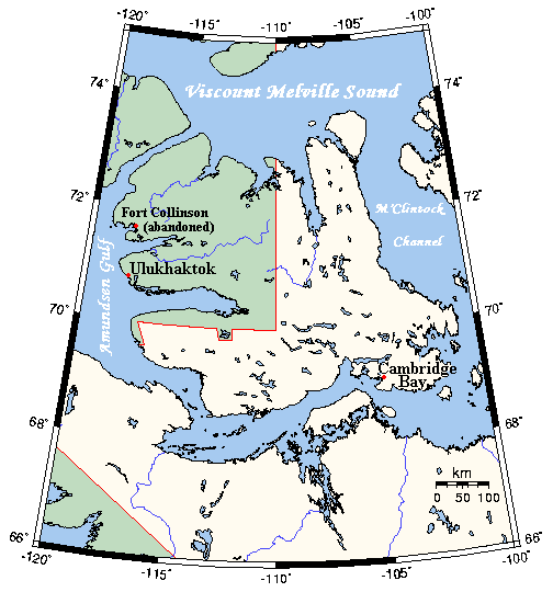
English: A map Victoria Island, Canada |
| Petsa | not specified |
| Taudan | This map's source is here, with the uploader's modifications, and the GMT homepage says that the tools are released under the GNU General Public License |
| Mannurat | Kelisi at en.wikipedia |
Lisensia
Ni Kelisi from en.wikipedia.org, ti agtengtengel ti karbengan ti kopia iti daytoy nga obra, ket agipablaak babaen ti sumaganad a lisensia:
| Daytoy a papeles ket nalisensiaan babaen ti Creative Commons Attribution-Share Alike 3.0 Unported a lisensia. Subject to disclaimers. | ||
| Pammadayaw: Kelisi from en.wikipedia.org | ||
| ||
| Daytoy nga etiketa ti panaglisensia ket nainayon iti daytoy a papeles a kas paset iti GFDL a panagbabaro ti panaglisensia. |

|
Maited ti pammalubos ti agkopia, agiwaras ken/wenno mangbaliw iti daytoy a dokumento babaen ti termino iti GNU Free Documentation License, Bersion 1.2 wenno ti ania man a kinaudi a bersion babaen ti Free Software Foundation; nga awan dagiti Sabsabali a Paset, awan dagiti Sanguan nga Aklub a Teksto, ken dagiti Likudan nga Aklub a Teksto. Ti kopia ti lisensia ket nairaman iti paset a natituluan iti GNU Free Documentation License. Subject to disclaimers. |
Kasisigud a listaan pang-ipan
All following user names refer to en.wikipedia.
- 2006-03-25 03:16 Kelisi 504×540×8 (21 KB) (A map of Victoria Island in the Northwest Territories and Nunavut. This map's source is [http://www.aquarius.geomar.de/omc/make_map.html here], with the uploader's modifications, and the [http://gmt.soest.hawaii.edu/ GMT homepage] says that the tools are )
Pakasaritaan ti papeles
Pinduten iti petsa/oras tapno makita ti papeles a kas naiparang iti dayta a panawen.
| Petsa/Oras | Bassit a ladawan | Dagiti rukod | Agar-aramat | Komentario | |
|---|---|---|---|---|---|
| agdama | 01:53, 31 Enero 2021 | | 504 × 540 (27 KB) | Kelisi | Oops! That was silly. Sorry, I'll try again.......... |
| 01:50, 31 Enero 2021 |  | 504 × 540 (27 KB) | Kelisi | Inhabited hamlets' names have been rendered in bigger type (Fort Collinson has been left smaller), and the local name Ulukhaktok has replaced the former, English name Holman, since the article about the place now has that title. | |
| 11:32, 13 Agosto 2008 |  | 504 × 540 (21 KB) | Telim tor | == Information == {{Information |Description={{en|A map Victoria Island, Canada}} |Source=This map's source is [http://www.aquarius.ifm-geomar.de/ here], with the uploader's modifications, and the [http://gmt.soest.hawaii.edu/ GMT homepage] says that the |
Panagusar iti papeles
Ti sumaganad a panid ket agus-usar iti daytoy a papeles:
Global a panagusar ti papeles
Dagiti sumaganad a wiki ket agus-usar iti daytoy a papeles:
- Panagusar idiay af.wikipedia.org
- Panagusar idiay bg.wikipedia.org
- Panagusar idiay bs.wikipedia.org
- Panagusar idiay ca.wikipedia.org
- Panagusar idiay ckb.wikipedia.org
- Panagusar idiay da.wikipedia.org
- Panagusar idiay en.wikipedia.org
- Panagusar idiay eo.wikipedia.org
- Panagusar idiay es.wikipedia.org
- Panagusar idiay fa.wikipedia.org
- Panagusar idiay gl.wikipedia.org
- Panagusar idiay hu.wikipedia.org
- Panagusar idiay nn.wikipedia.org
- Panagusar idiay no.wikipedia.org
- Panagusar idiay pl.wikipedia.org
- Panagusar idiay ro.wikipedia.org
- Panagusar idiay th.wikipedia.org
- Panagusar idiay tt.wikipedia.org
- Panagusar idiay www.wikidata.org
- Panagusar idiay zh.wikipedia.org